| |

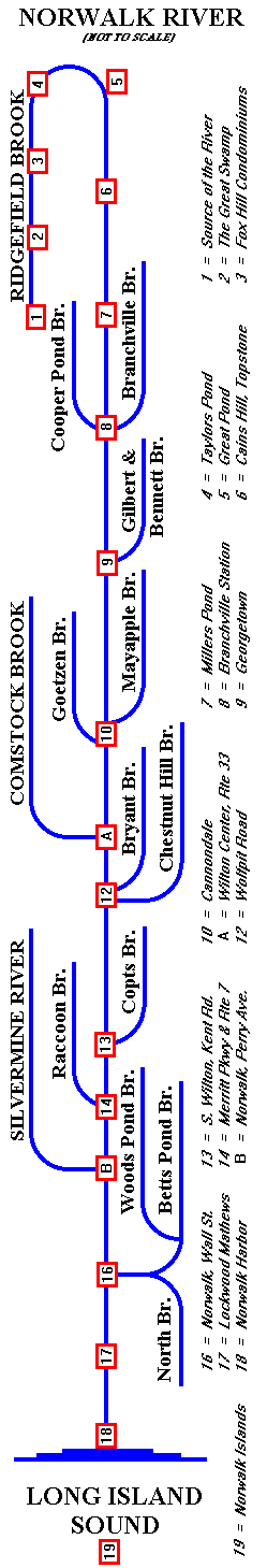
The
map below shows the main branch of the Norwalk River, which
begins near the center of Ridgefield, CT, goes north along
Route 35, then reverses direction and goes south along Route
7 through Wilton and Norwalk, emptying into Long Island Sound
at Norwalk Harbor, approximately 40 miles from New York City.
Please
pick any NAME or NUMBER on the map to see pictures
of the watershed at that point. The map scrolls vertically
using its scroll bar. The Norwalk River's two largest tributaries,
the Silvermine River and the Comstock Brook are shown in separate
maps, which will appear automatically when they're needed.
Or,
come join us on a tour of the Norwalk
River, the Silvermine
River, or the Comstock
Brook. Or return to the NRWA Home Page.
|
|