The
Norwalk River Pictorial Atlas
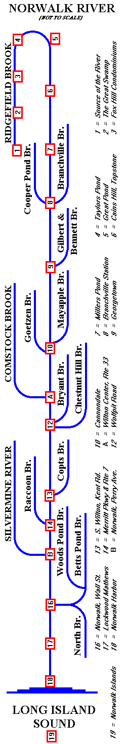
The
Norwalk River flows north from the center of Ridgefield
(near point 1 on the map) up to Taylors Pond, about one
mile west of the intersection of Routes 35 and 7 (point
4). This section of the river is often called Ridgefield
Brook.
Here
the river turns east and then south, following Route 7 through
Branchville, Georgetown, Connondale, Wilton Center, South
Wilton, Winnipauk, Norwalk, and finally South Norwalk opposite
Norwalk Harbor (point 18). Boaters can follow the river's
course to the Norwalk Islands, one mile out into Long Island
Sound (point 19).
Please
PRESS HERE FOR A TOUR downriver
from the source. You may pick any NAME or NUMBER on
the map to see pictures of the watershed at a specific point.
|